


Google Maps screenshots (13)





Description Google Maps
The Definitive Global Navigation and Mapping Platform
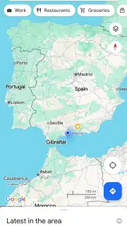
Google Maps operates as a comprehensive geospatial utility, providing detailed cartographic data, real-time logistical routing, and extensive point-of-interest information worldwide. It functions as an essential tool for urban navigation, travel planning, and local discovery, integrating satellite imagery, street-level panoramic views, and user-generated content to create a multi-layered representation of the physical world. The application processes vast datasets to deliver precise turn-by-turn guidance for multiple modes of transport, dynamically adjusting to current traffic flow, road incidents, and public transit schedules. Its functionality extends beyond basic directions to include offline access, real-time location sharing, and personalized place recommendations based on user behavior and saved locations.
Core Functional Capabilities
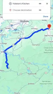
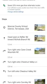
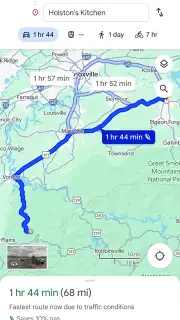
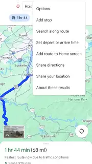
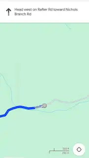
The application’s primary operational mode involves calculating optimal routes for driving, walking, cycling, and public transportation. It processes real-time GPS data alongside historical and live traffic conditions to suggest the most efficient path, providing audible and visual turn-by-turn navigation. The system continuously monitors for accidents, road closures, and construction, offering automatic rerouting options to minimize delays. For public transit, it integrates schedules for buses, trains, trams, and ferries in thousands of cities, providing step-by-step itineraries including departure times, walking segments to stations, and fare estimates.
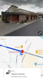
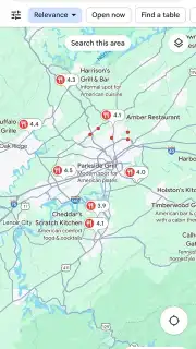
A distinct analytical layer offers detailed insights into over 200 million places and businesses. Users can search for specific categories—such as restaurants, gas stations, pharmacies, or tourist attractions—and view operational data including hours of service, contact information, and popular times to visit. This is supplemented by a crowdsourced database containing user-submitted photographs, written reviews, and aggregate rating scores, enabling informed decision-making. The integrated Street View feature allows for virtual ground-level exploration of neighborhoods, providing 360-degree panoramic imagery to verify locations, scout areas, or preview destinations before arrival.
The platform includes several utility-focused subsystems for specialized use cases. Offline Maps is a dedicated tool allowing users to download vector and satellite data for entire cities or regions to a device’s local storage, enabling full search and navigation functionality without an active internet connection. The Live Location Sharing system generates a temporary, shareable link that transmits your real-time position on the map to selected contacts for a defined duration, facilitating meet-ups and safety check-ins. Furthermore, the application supports list creation, allowing users to save, categorize, and label favorite or planned destinations (e.g., "Want to go," "Favorites," "Starred places") for quick future access and to seed its recommendation algorithms.
- Real-time traffic-aware navigation
- Offline maps for areas without connectivity
- Detailed business information and photos
- Integrated public transit and cycling routes
- Live location sharing with contacts
- Street View and satellite imagery layers
Download the Google Maps mobile app now and transform your device into a professional-grade navigation and discovery terminal. Install it immediately to eliminate uncertainty from every journey.
Disclaimer: This application requires an internet connection for full functionality, including real-time traffic, routing, and search, though core navigation is available offline with pre-downloaded maps. It uses GPS location data, which can decrease battery life. The app is free to download and use; however, certain services or integrations within partnered platforms may involve separate transactions. It is intended for general use by individuals who meet the terms of service age requirements. Data usage applies when downloading maps, using navigation, and loading imagery; usage can be significant, especially with high-resolution satellite views or prolonged navigation sessions. User-submitted content, such as reviews and photos, is publicly visible according to Google's privacy policy.
Information
| Version | 26.35.00.969485213 |
| Developer | Google Inc. |
| Requirements | Android Android 9+ |
| Updated | 16.09.2026 |
| Size | 287.45 MB |
| Package | com.google.android.apps.maps |
| Signature | 38918a453d07199354f8b19af05ec6562ced5788 |
| Architecture | arm64-v8a, armeabi-v7a, x86, x86_64 |


