


Ship Doc screenshots (8)
Description Ship Doc
Ever wondered what ships are sailing past your coastline right now, or how to track a specific vessel across the globe in real time?
Ship Doc transforms your device into a powerful maritime terminal, granting you direct access to the live movements and detailed specifications of the world's commercial and recreational fleets. This application leverages the global AIS (Automatic Identification System) network, the same technology used by vessels and port authorities for navigation and safety. By tapping into this data stream, Ship Doc delivers a professional-grade tracking experience, placing a comprehensive overview of global maritime traffic directly in your hands. Whether you're a maritime enthusiast, a professional in the industry, or simply curious about the ships around you, this app turns the world's oceans into a transparent and interactive map.
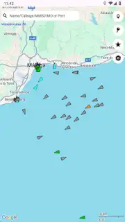
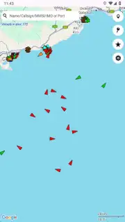
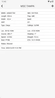
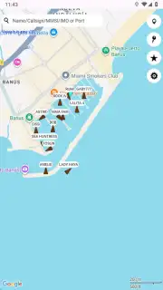
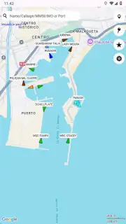
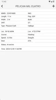
The core functionality revolves around a dynamic global map that you can seamlessly zoom and pan to inspect any region. View all AIS-equipped vessels as icons, with their courses and speeds visualized. For targeted searches, utilize multiple identification parameters: search directly by vessel name, its unique MMSI number, or its official IMO number for instant, precise location. Beyond simple tracking, selecting any vessel reveals a rich data profile. This includes real-time status (moored, anchored, or underway), current speed and heading, exact dimensions like length and beam, flag state, call sign, destination, and estimated time of arrival.
Core Features and Tools
- Live Global AIS Tracking: Monitor vessel movements worldwide on an interactive map with real-time position updates.
- Multi-Parameter Vessel Search: Instantly locate ships using name, unique MMSI, or official IMO number search filters.
- Detailed Vessel Profiles: Access specifications like dimensions, flag state, call sign, speed, course, and navigational status.
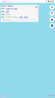
- Voyage Information Display: View a ship’s destination, draught, and calculated Estimated Time of Arrival (ETA) for vessels en route.
- Port and Area Traffic Analysis: Zoom into any harbor or sea area to see all present vessels and analyze local maritime traffic density.
We suggest trying Ship Doc to satisfy your curiosity about maritime movements or to add a powerful tool to your professional toolkit. Consider downloading it to gain an unprecedented window onto the world's shipping lanes, ports, and coastal waters.
Heads up: you'll need wifi or mobile data for live map features and real-time AIS data updates. Some advanced data layers and historical tracking are part of the premium Turbo version.
Information
| Version | 2.0.2 |
| Developer | MarineToolbox |
| Requirements | Android Android + 8.0+ |
| Updated | 17.03.2026 |
| Size | 17.55 MB |
| Package | co.findship.ShipDoc |
| Signature | dce9a72c649d31ba461fd8ded5b9e308 |
| Architecture | armeabi-v7a, x86, arm64-v8a, x86_64 |


