


MAPinr - KML/KMZ/OFFLINE screenshots (12)





Description MAPinr - KML/KMZ/OFFLINE
Tired of losing your maps when the signal drops?
MAPinr transforms your phone into a full-fledged, professional-grade GPS device. It’s built for explorers, surveyors, and adventurers who need to rely on their maps anywhere—deep in the forest, on a remote mountain trail, or in a city with spotty coverage. This isn't just a viewer; it's a powerful toolkit for managing, analyzing, and navigating with complex geographic data directly on your Android device.
Your Pocket GIS: Powerful Tools for Real-World Navigation
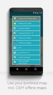
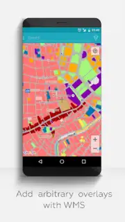
MAPinr is engineered for precision and independence. The core functionality revolves around loading, creating, and interacting with KML and KMZ files—the universal formats for storing placemarks, tracks, routes, and polygons. You can plot detailed points of interest, draw exact boundaries, and record your entire journey with high accuracy. The app provides multiple map layer sources, including OpenStreetMap and satellite imagery, which you can pre-download for entire regions. This means you can switch between a topographic view and a satellite photo seamlessly, even while offline. For professionals, features like coordinate display in various formats (Decimal Degrees, UTM), area and distance measurement tools, and the ability to import/export data make it an indispensable field companion.
Key Advantages That Set MAPinr Apart
- Complete Offline Freedom: Download vector and satellite maps for entire countries or regions. Once saved, navigate, search, and zoom without any internet connection.
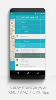
- Professional KML/KMZ Handling: Fully import, edit, and export complex KML/KMZ files. Manage nested folders, styles, and descriptions for sophisticated project organization.
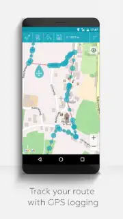
- Advanced GPS Tracking: Record your tracks with configurable intervals and accuracy filters. View real-time stats like speed, altitude, and bearing directly on your map screen.
- Multi-Layer Map Display: Stack and toggle between different offline map sources (e.g., road maps, terrain, satellite) to get the perfect view for your activity.
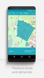
- Precision Measurement Tools: Instantly calculate the area of any drawn polygon or the exact distance between multiple points using the on-screen measuring tool.
Don't just hope for a signal—carry your maps with you. Download MAPinr now and turn your Android device into your most reliable navigator.
Heads up: you'll need wifi for initial map downloads and some layer updates. Some advanced map source integrations are extra. Requires Android 7.0 or newer.
Information
| Version | 4.3.7 |
| Developer | Xylem Technologies |
| Requirements | Android Android + 7.0+ |
| Updated | 17.03.2026 |
| Size | 88.64 MB |
| Package | at.xylem.mapin |
| Signature | ffb147d74ae37deb2f322b652822142f |
| Architecture | armeabi-v7a, x86, arm64-v8a, x86_64 |


